
Location – Near Nenagh along the R491.
OS: R 907 805 (map 59)
Longitude: 8° 8' 17.3" W
Latitude: 52° 52' 31.33" N
See map at the bottom of the page.
Description and History – This was a truly great find and I was glad I decided to go there because it was not on my agenda on the day I saw this place. This site is lost in time and unless you set out to find it you could easily walk by without ever knowing that it was there. What is fantastic about this site is that it shows the reusing of a site from an earlier period and had a medieval church within an Iron Age/early Christian ringfort.
Ringfort – The ringfort is in excellent condition but is somewhat overgrown. It is roughly 55m in diameter with an inner and outer bank and fosse and a walkway leading to the interior. The NE portion of the rath has been levelled somewhat but still visible. This would have been an easily defendable rath as it is located on the summit of hill and would have commanded good views of the surrounding country side before becoming overgrown with trees.
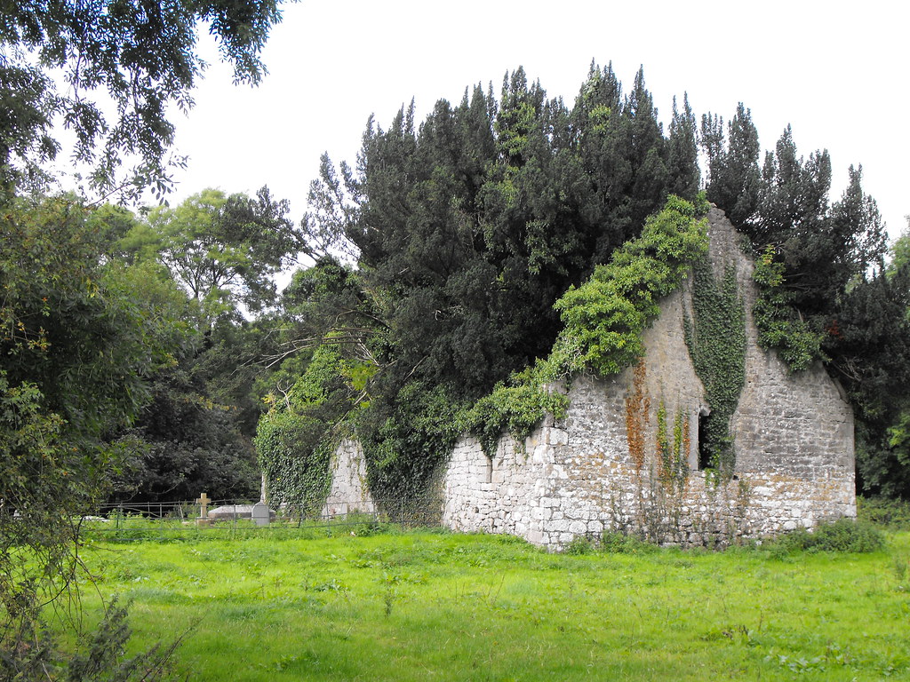
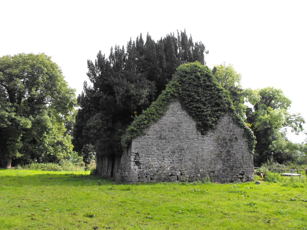
Church – The church is located in the interior of the ringfort and has a small private burial plot attached to it. The church is in a poor state of repair but retains all of it walls to full height but has many trees growing inside. Built in the 15th century beams are still visible that would have supported attic accommodation space. Window spaces still survive in the E and W gables.
Difficulty – Access from the R491 is through a farmyard which is extremely muddy. When I arrived at the farmyard there was nobody there and there were many electric fences crossing the pathway. I decided to approach the site from the other side of the hill which proved much easier. There was still some electric fence negotiating however when I arrived at the site. The interior of the rath is a little marshy, especially around the small graveyard and many of the graves are collapsing in on themselves so I would recommend staying outside of the plot. The church is closed but the gate can easily be climbed over. The interior is hard to navigate because of the trees and undergrowth. I didn’t get as good of a look as I would have liked inside as I unusually came across a badger so I had to make a quick exit.
For more ecclesiastical sites, click here.
For more ringforts, click here.
For more sites in Co. Tipperary, click here.
OS: R 907 805 (map 59)
Longitude: 8° 8' 17.3" W
Latitude: 52° 52' 31.33" N
See map at the bottom of the page.
Description and History – This was a truly great find and I was glad I decided to go there because it was not on my agenda on the day I saw this place. This site is lost in time and unless you set out to find it you could easily walk by without ever knowing that it was there. What is fantastic about this site is that it shows the reusing of a site from an earlier period and had a medieval church within an Iron Age/early Christian ringfort.
Ringfort – The ringfort is in excellent condition but is somewhat overgrown. It is roughly 55m in diameter with an inner and outer bank and fosse and a walkway leading to the interior. The NE portion of the rath has been levelled somewhat but still visible. This would have been an easily defendable rath as it is located on the summit of hill and would have commanded good views of the surrounding country side before becoming overgrown with trees.
Church – The church is located in the interior of the ringfort and has a small private burial plot attached to it. The church is in a poor state of repair but retains all of it walls to full height but has many trees growing inside. Built in the 15th century beams are still visible that would have supported attic accommodation space. Window spaces still survive in the E and W gables.
Difficulty – Access from the R491 is through a farmyard which is extremely muddy. When I arrived at the farmyard there was nobody there and there were many electric fences crossing the pathway. I decided to approach the site from the other side of the hill which proved much easier. There was still some electric fence negotiating however when I arrived at the site. The interior of the rath is a little marshy, especially around the small graveyard and many of the graves are collapsing in on themselves so I would recommend staying outside of the plot. The church is closed but the gate can easily be climbed over. The interior is hard to navigate because of the trees and undergrowth. I didn’t get as good of a look as I would have liked inside as I unusually came across a badger so I had to make a quick exit.
For more ecclesiastical sites, click here.
For more ringforts, click here.
For more sites in Co. Tipperary, click here.
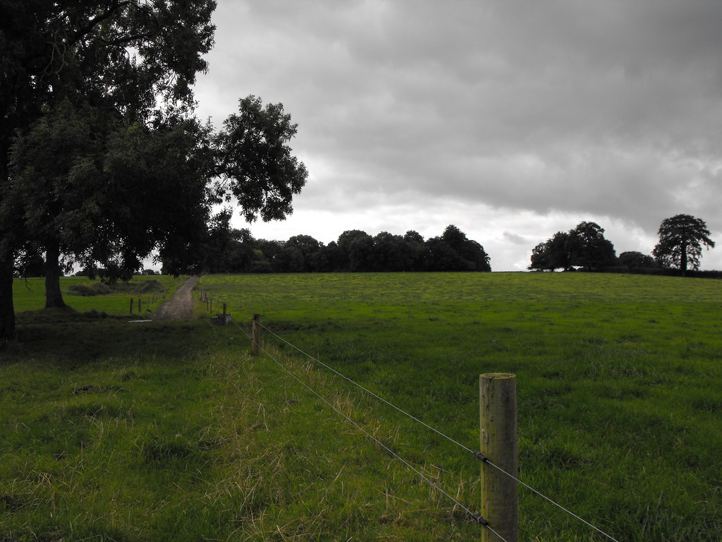
The overgrown rath from the bottom of the hill.
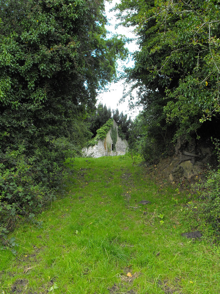
The first glimpse of the church through the trees.
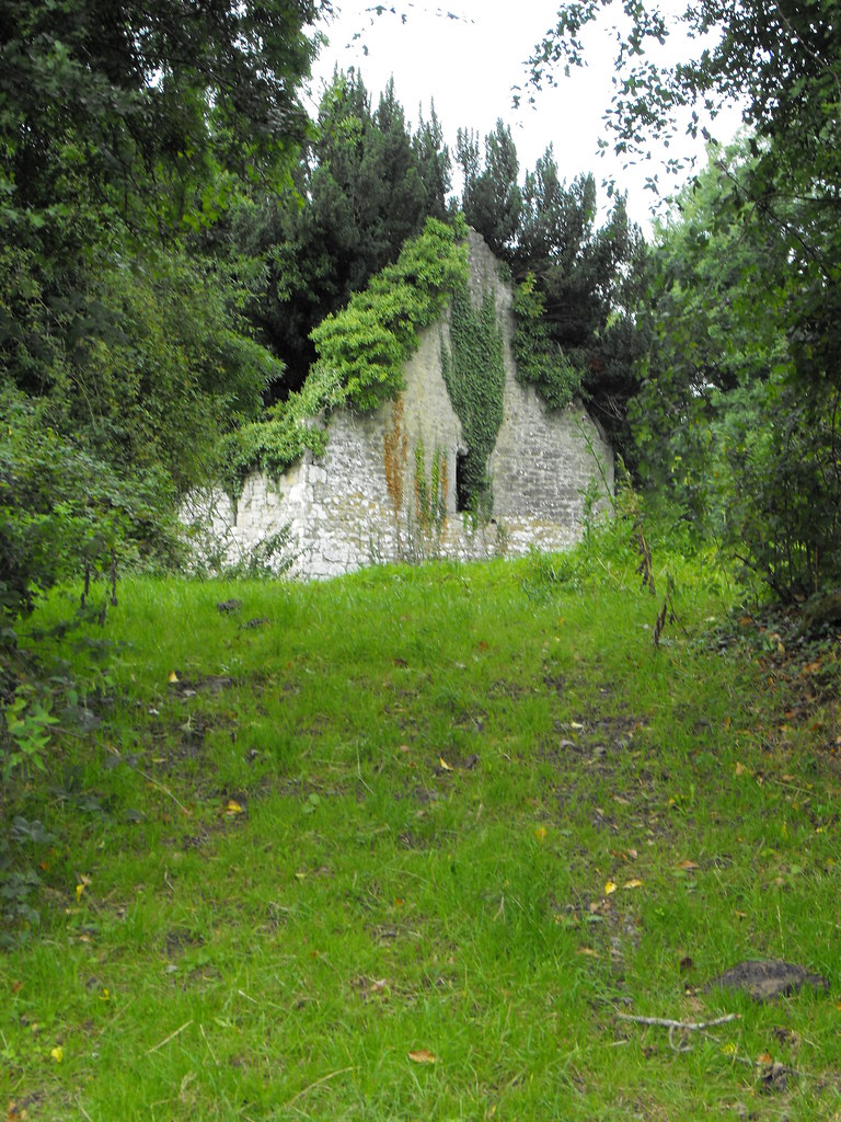
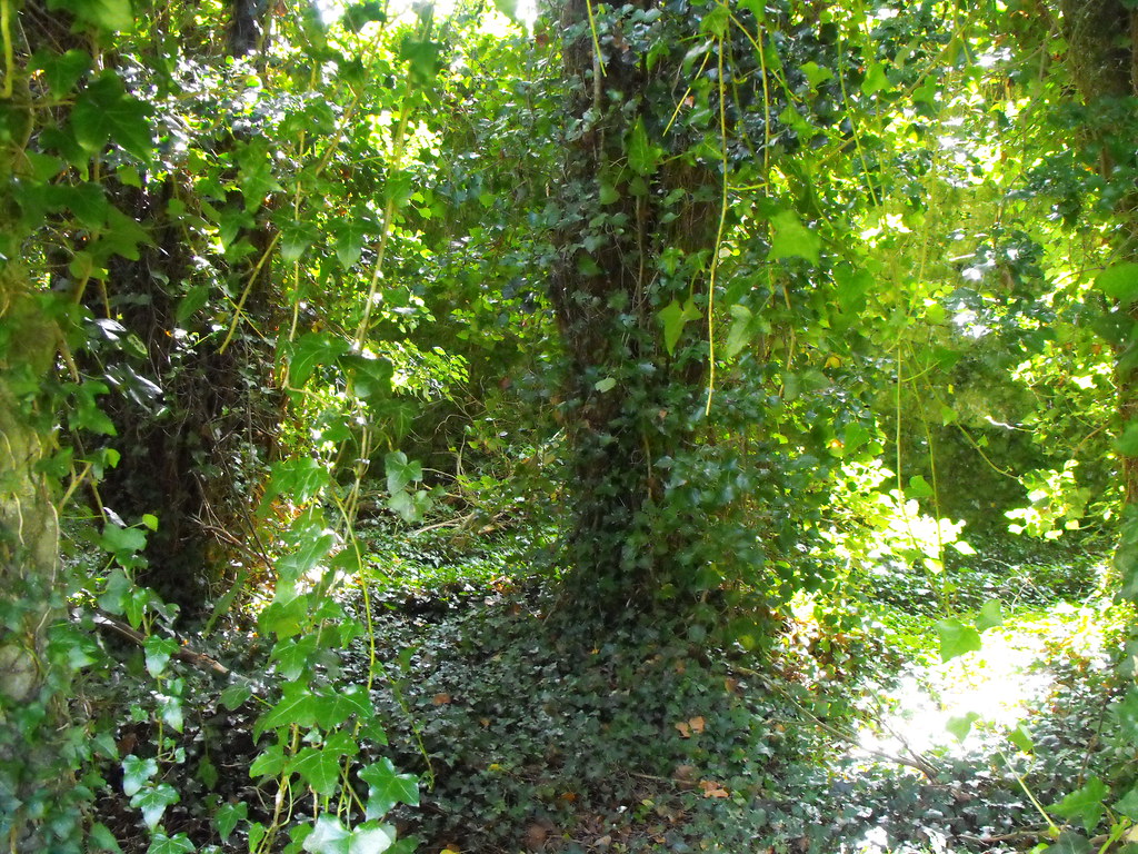
As you can see, vegetation has taken this church over.
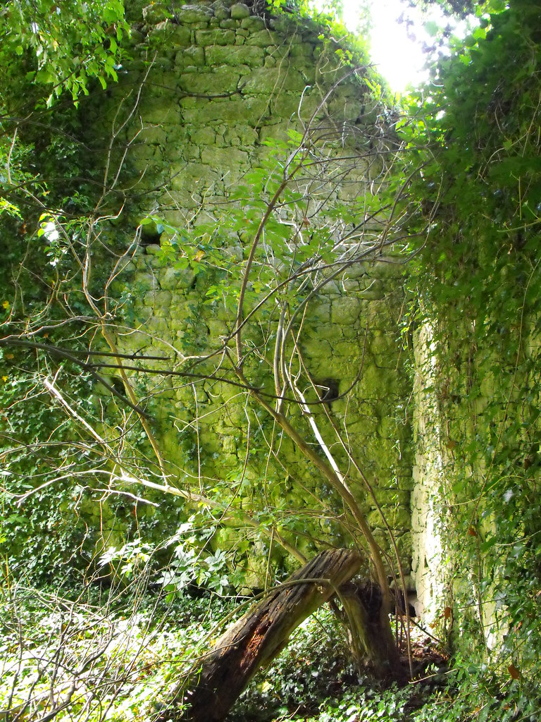
Inside the church.
In places it is hard to know that you are actually inside a building.
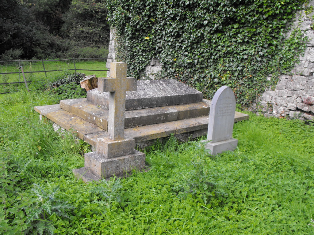
The small graveyard.

This large stone was outside the rath. I wonder if it is a fallen standing stone associated with the rath.
View The Standing Stone in a larger map